


3B Turtletown Voting District, Polk County, Tennessee
About
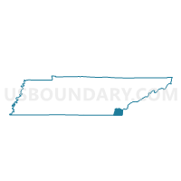
Outline

Summary
| Unique Area Identifier | 669357 |
| Name | 3B Turtletown Voting District |
| County | Polk County |
| State | Tennessee |
| Area (square miles) | 38.06 |
| Land Area (square miles) | 37.55 |
| Water Area (square miles) | 0.51 |
| % of Land Area | 98.65 |
| % of Water Area | 1.35 |
| Latitude of the Internal Point | 35.15062140 |
| Longtitude of the Internal Point | -84.35276370 |
Maps


Graphs
Select a template below for downloading or customizing gragh for 3B Turtletown Voting District, Polk County, Tennessee


Neighbors
Neighoring Voting District (by Name) Neighboring Voting District on the Map
- 12 Coker Creek School Voting District, Monroe County, TN
- 2 Greasy Creek Comm. Club Voting District, Polk County, TN
- 2A Springtown Firehall Voting District, Polk County, TN
- 3 Ducktown Courthouse Voting District, Polk County, TN
- Voting District BEAV, Cherokee County, NC
- Voting District HIWA, Cherokee County, NC
Top 10 Neighboring County Subdivision (by Population) Neighboring County Subdivision on the Map
- District 3, Monroe County, TN (13,442)
- District 2, Polk County, TN (5,658)
- District 3, Polk County, TN (5,002)
- Shoal Creek township, Cherokee County, NC (2,290)
- Beaverdam township, Cherokee County, NC (797)
Top 10 Neighboring Unified School District (by Population) Neighboring Unified School District on the Map
- Monroe County School District, TN (32,521)
- Cherokee County Schools, NC (27,444)
- Polk County School District, TN (16,825)
Top 10 Neighboring State Legislative District Lower Chamber (by Population) Neighboring State Legislative District Lower Chamber on the Map
- State House District 120, NC (72,565)
- State House District 22, TN (64,839)
- State House District 23, TN (64,022)
Top 10 Neighboring State Legislative District Upper Chamber (by Population) Neighboring State Legislative District Upper Chamber on the Map
- State Senate District 5, TN (207,003)
- State Senate District 9, TN (179,807)
- State Senate District 50, NC (175,858)
Top 10 Neighboring 111th Congressional District (by Population) Neighboring 111th Congressional District on the Map
- Congressional District 2, TN (723,798)
- Congressional District 11, NC (703,606)
- Congressional District 3, TN (692,346)
Top 10 Neighboring Census Tract (by Population) Neighboring Census Tract on the Map
- Census Tract 9255.02, Monroe County, TN (5,283)
- Census Tract 9306.02, Cherokee County, NC (3,931)
- Census Tract 9504, Polk County, TN (3,457)
- Census Tract 9306.01, Cherokee County, NC (3,280)
- Census Tract 9303, Cherokee County, NC (2,439)
- Census Tract 9502.01, Polk County, TN (2,226)
- Census Tract 9501, Polk County, TN (1,545)
Top 10 Neighboring 5-Digit ZIP Code Tabulation Area (by Population) Neighboring 5-Digit ZIP Code Tabulation Area on the Map
- 28906, NC (18,475)
- 37385, TN (8,131)
- 37317, TN (2,403)
- 37391, TN (1,598)
- 37369, TN (956)
- 37333, TN (534)